Using mapping grade GPS to capture features in Alameda Open Space, Albuquerque, NM
Overview of GPS tracking with TDC-100.
The goal of this project was to map all openspace features. This includes park benches, trees, trails, trashcans and more. Equiped with a TDC-100, each set of features were collected with their own layer. This allowed to easily transfer coordinates and data to a GIS. The map was created as an aid for park employees to audit all property easier. Also, it can be turned into a map for visitors.
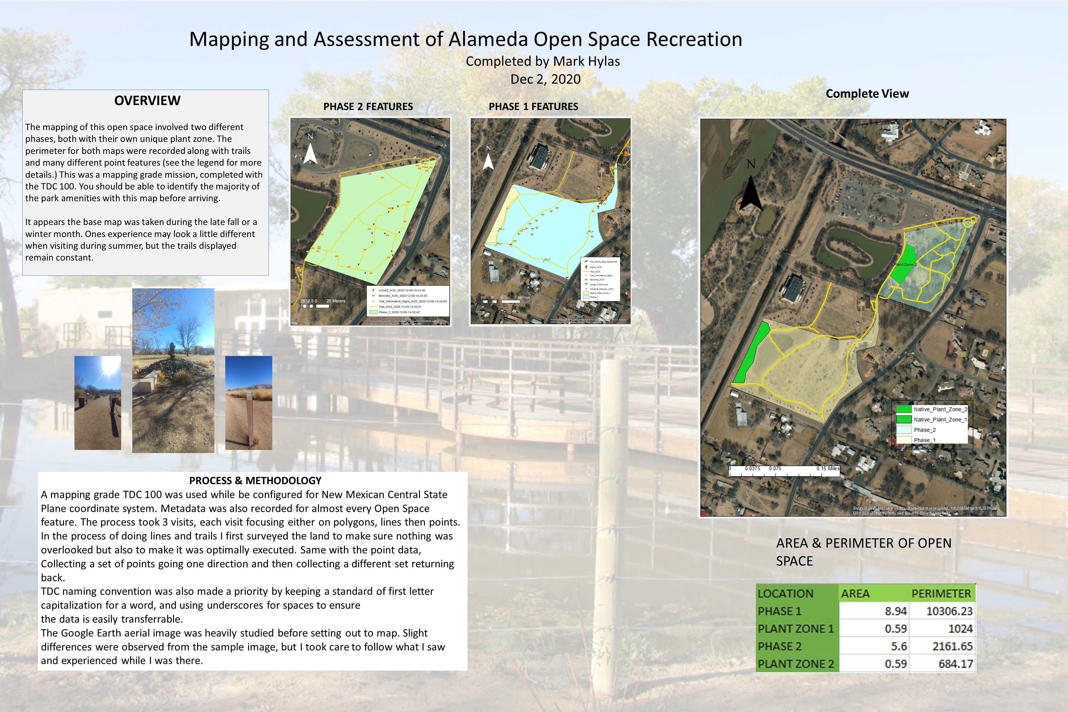
Final map including both phases.
At the end of the data collection I had just over 120 fields to parse through and import into the GIS. The field work also included getting the the peremeter of the open space and including the area/sq ft. I simply did this by using ArcMaps "calcualte geometry" after establishing a coordinate system. The majority of the work was done with the TDC-100 and some terrestial photography.

Phase 1
Bording the famous Paseo del Bosque Trail, phase 1 covers the more open area to walk around. There is a noticable error with the additional path that I included in phase 1. I considered removing this in a vector editor, but I wanted the spatial data to reflect exactly what the GPS mapping device collected.

Phase 2
Phase two has closer access to the main parking lot. You are provided with a sellection of short trails and sufficient tree coverage. Nothing too large to get lost in but as detailed in the map, you will have ample seating if a visitor gets tired. The field work was completed in a single visit since the TDC-100 can easily toggle between features as I am surveying and collecting data points.