A technical comparison between RTK and mapping grade GPS.
Understanding the accuracy of both GPS technologies.
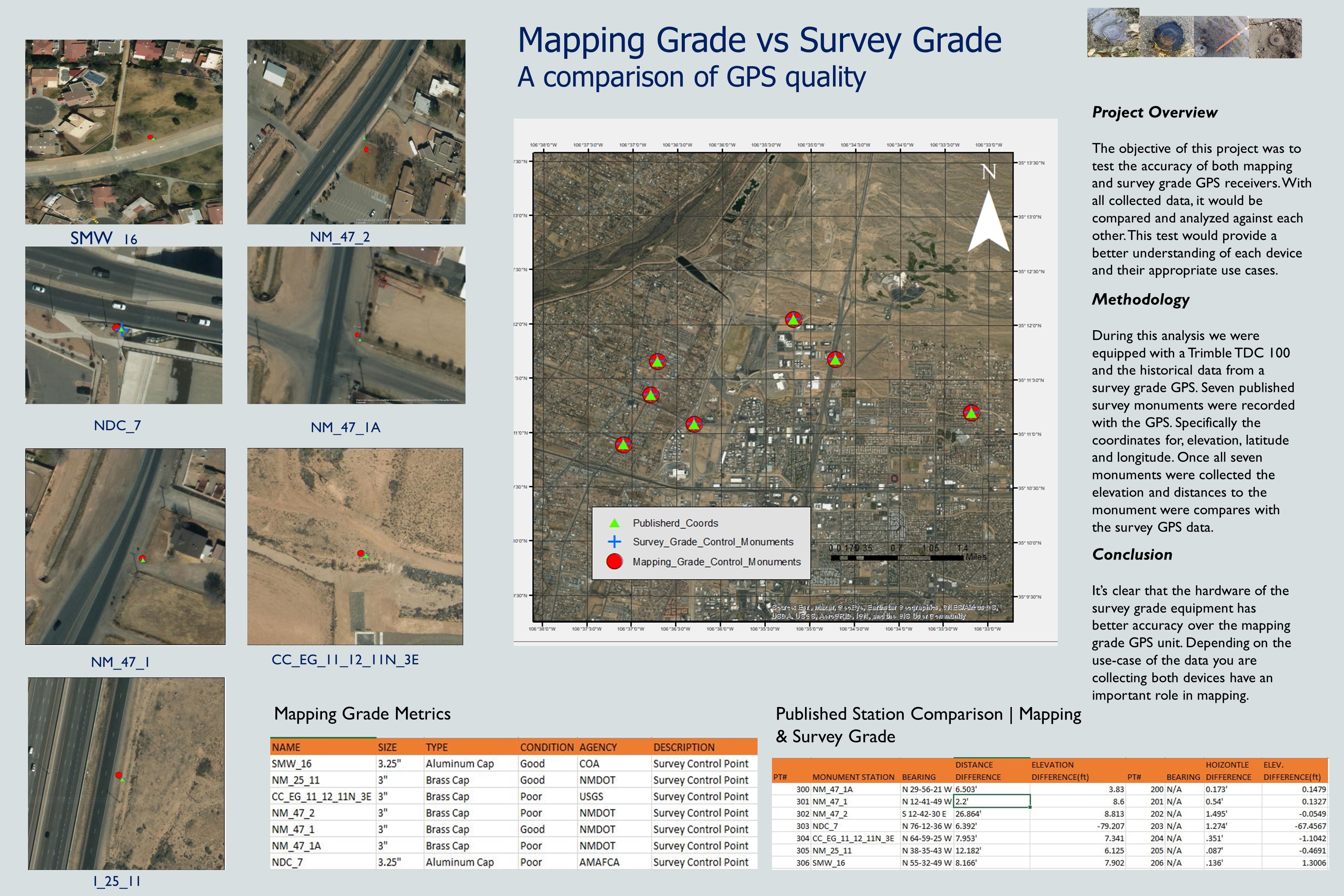
Good decisions require good data. For GIS users, the quality of data coming out of their analysis depends on the accuracy of the data going in. In this project I tested the difference between mapping grade and RTK grade GPS.
Using survey monuments to compare both GPS devices.
This project mapped out the location of survey markers in Albuquerque, NM. Both mapping grade and real time kinematic GPS devices were used. As per each GPS device capabilities, the mapping grade GPS provided sub meter acuraccy, while RTK is accurate down to a centimeter.
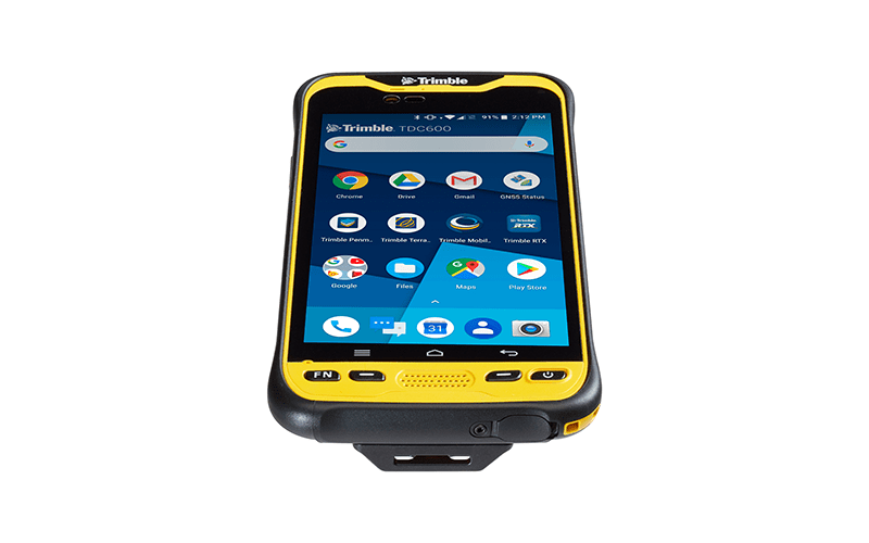
Mapping Grade GPS
To the right is an example of a mapping grade GPS. There are many reasons to use a device with only sub meter accuracy. The two most common reasons are cost, portability and speed of use. Recording spatial data on the fly fast-tracks the mapping and data analysis process.
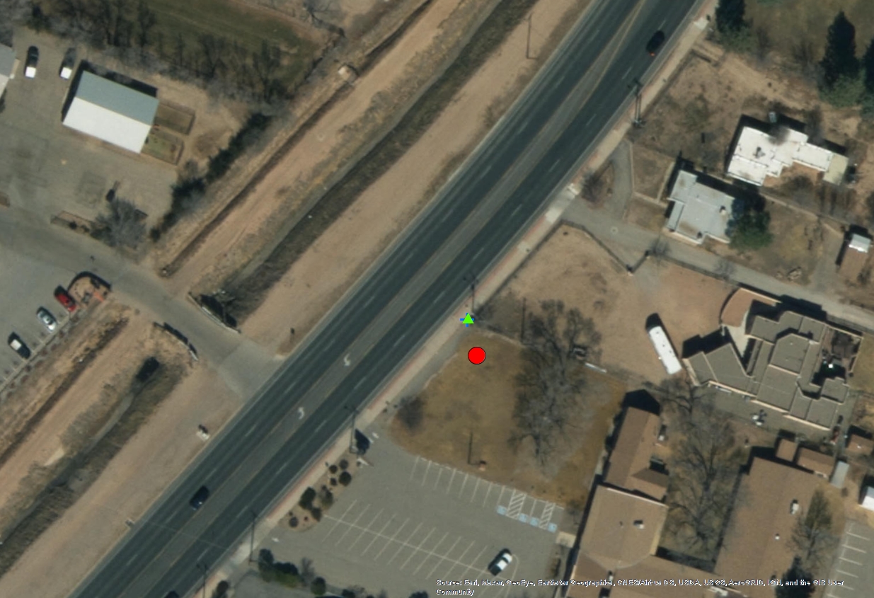
Survey marker close up
Photo to the left provides a closer look of a survey marker (the blue cross) and the accuracy delta between RTK and mapping grade GPS.