Displaying how the Appalachian Trail traverses through our native territories of influence.
Completed map with all territories of influence that touch the A.T.
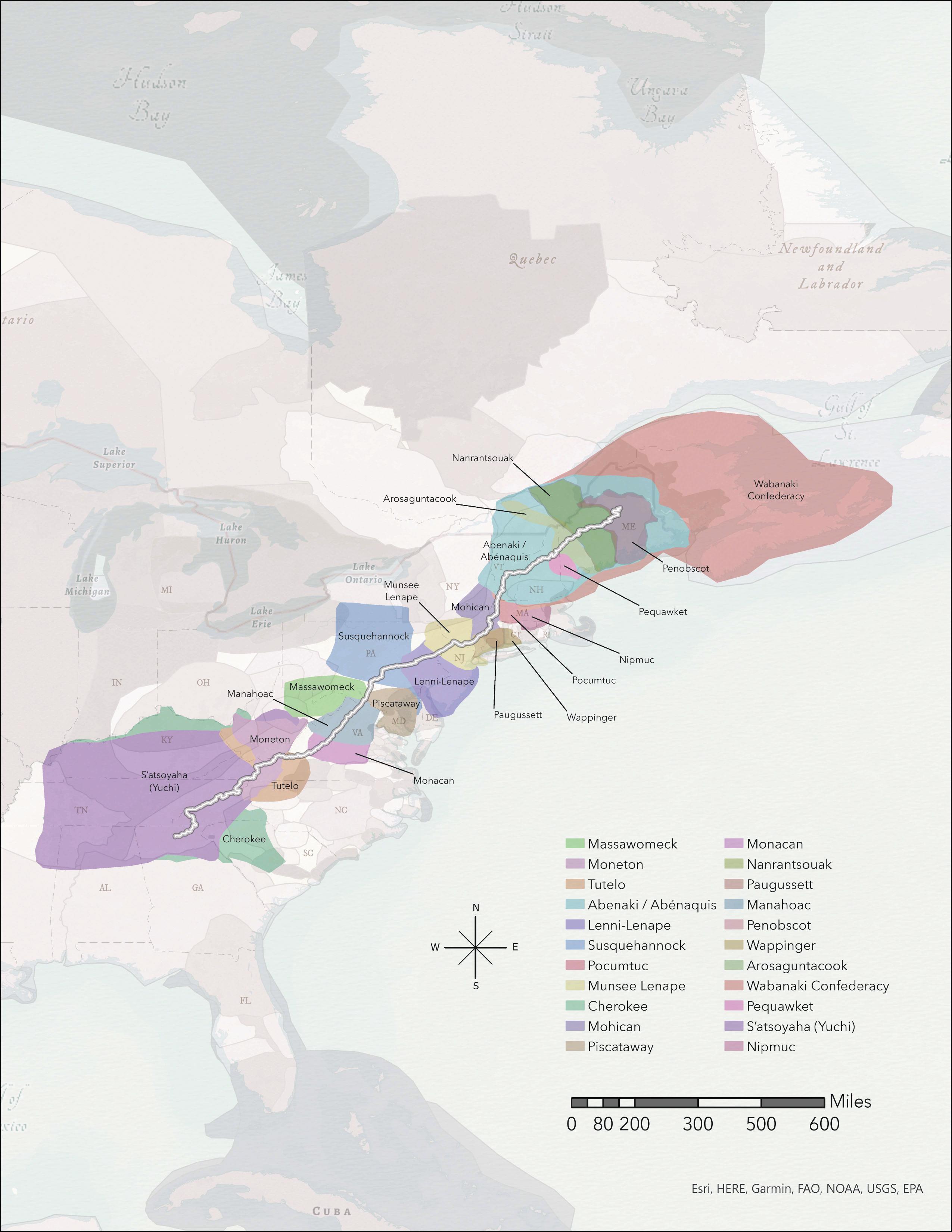
Below is the completed map that displays every territory that the A.T. Traverses through. The A.T. runs through 22 Native Nations' traditional territories and holds an abundant amount of Indigenous American history. This A.T. map was created to provide A.T. hikers with a better understanding of the territories they are traversing through.
Completed map with all territories of influence that touch the A.T.
This is the completed map that displays every territory that the A.T. Traverses through. The A.T. runs through 22 Native Nations' traditional territories and holds an abundant amount of Indigenous American history. This A.T. map was created to provide A.T. hikers with a better understanding of the territories they are traversing through.
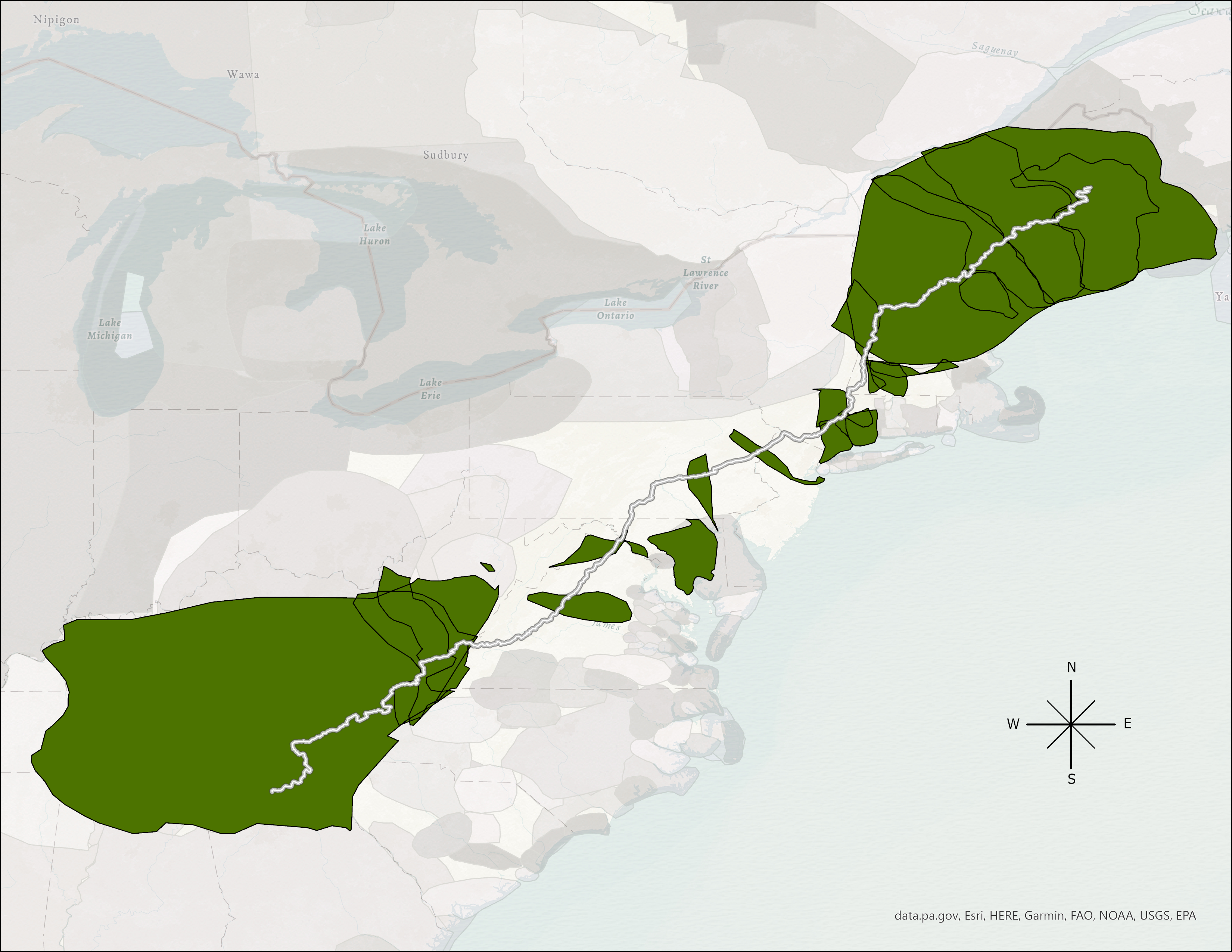
Intersect of Territories
A part of this project was to showcase the ability of ArcGIS Pro overlay toolset concepts. The map to the right shows only territories where they overlapped.
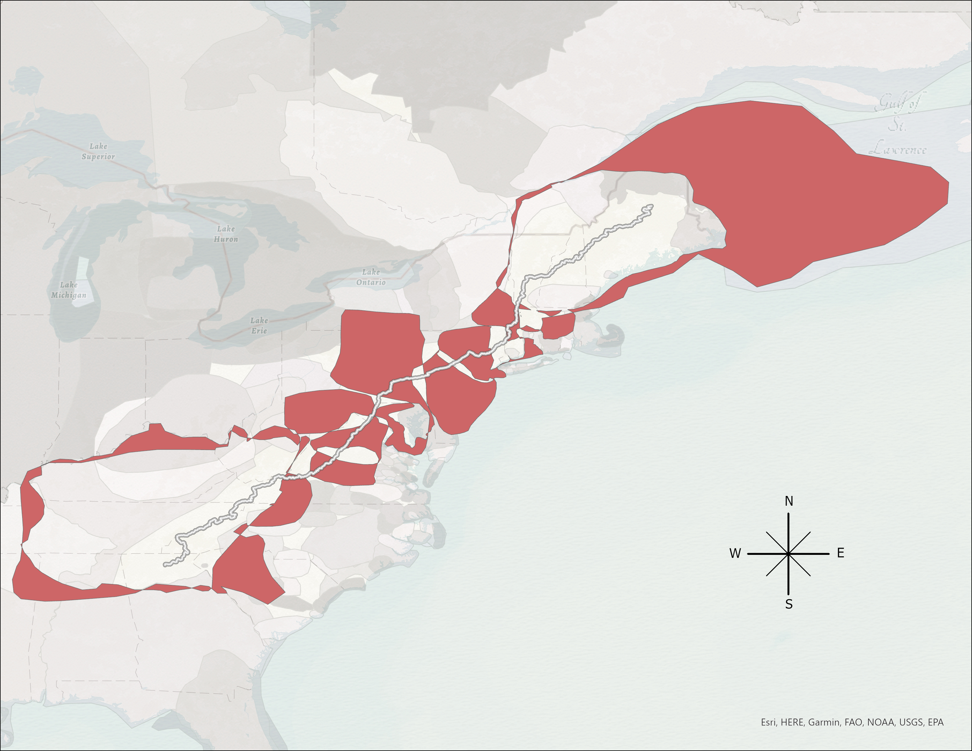
Erase Overlay
This is the output of the erase tool. Similar overlay tool but this time I only displayed parts of territories that avoid overlap.