Subtitle for high point
A brief overlook of what 3D analysis can provide.
I grew up next to HighPoint, NJ and I have always been curious hike around this famous natural state monument. Naturally, other quesitons arise such as how steep is this point compared to other points of NJ, or how does this terrain compare with the other two thirds of the state. Some basic analysis was done to a DEM map of NJ to help answer some of these questions.
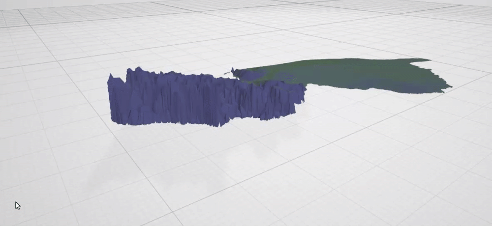
DEM to 3D Model
The highest point of New Jersey is unironically called, High Point. It sits at 1,804 feet and drastically declines to below 200 feet for central and south New Jersey. This is 3D image was produced from a statewide DEM. ArcGIS 3D scenes was the tool used to create this model.

Height Analysis
Nullam et orci eu lorem consequat tincidunt vivamus et sagittis magna sed nunc rhoncus condimentum sem. In efficitur ligula tate urna. Maecenas massa sed magna lacinia magna pellentesque lorem ipsum dolor. Nullam et orci eu lorem consequat tincidunt. Vivamus et sagittis tempus.
Sed nunc ligula
Nullam et orci eu lorem consequat tincidunt vivamus et sagittis magna sed nunc rhoncus condimentum sem. In efficitur ligula tate urna. Maecenas massa sed magna lacinia magna pellentesque lorem ipsum dolor. Nullam et orci eu lorem consequat tincidunt. Vivamus et sagittis tempus.